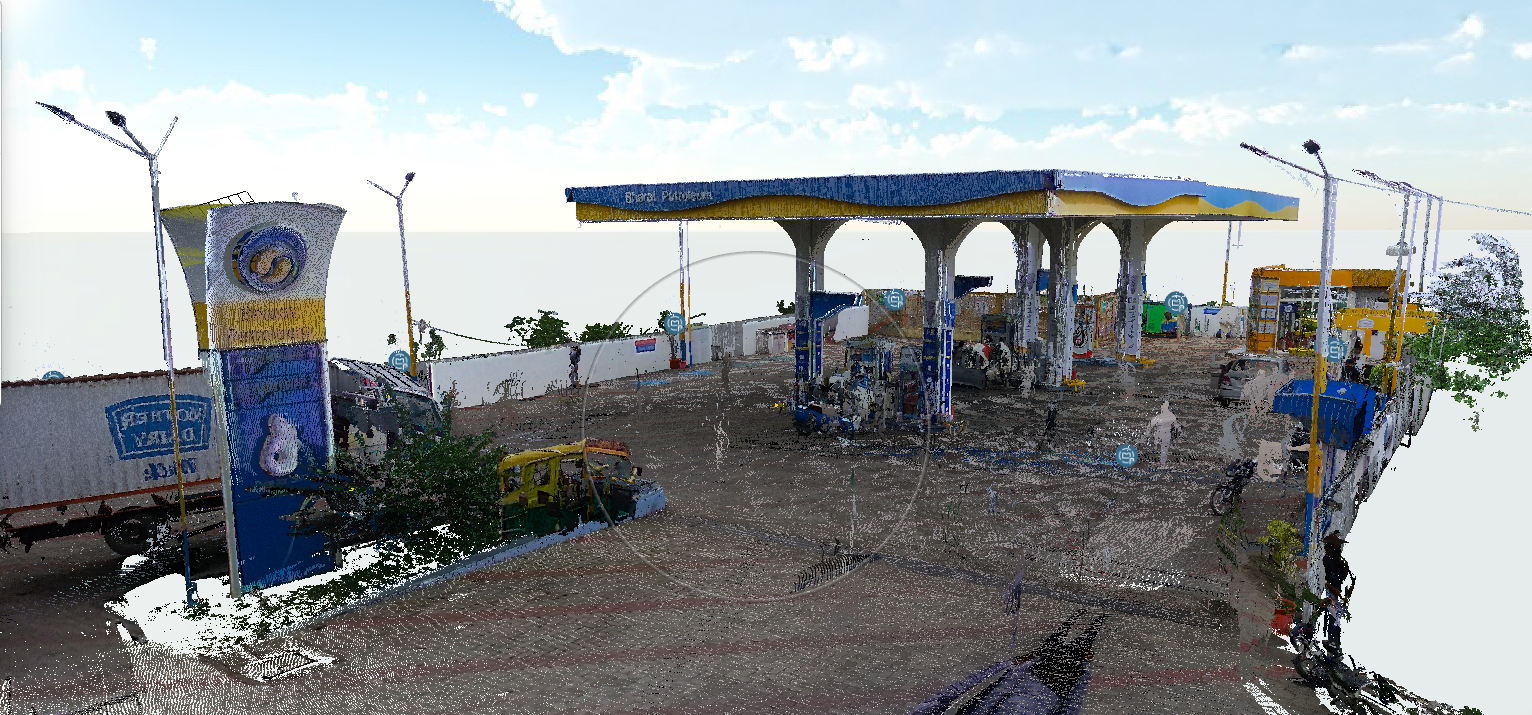
Twin Earth’s Large Geospatial Model is built on diverse real-world data collected across Indian environments using ground-based sensors, mobile platforms, and overhead sources such as drones and satellites. This data is carefully processed, aligned, and fused to capture the complexity of Indian urban, semi-urban, and rural landscapes—including dense cities, heritage zones, agricultural regions, and infrastructure corridors.
Our model is designed to deliver three core services tailored to Indian scenarios:
Reconstruct
Generate accurate and scalable 3D representations of real-world environments, even in challenging conditions such as unstructured roads, varying illumination, and dense population settings.
Localize
Enable robust and precise localization across diverse Indian terrains, including GPS-denied or low-connectivity areas.
Understand
Extract semantic and contextual insights from geospatial data to support applications like smart cities, infrastructure monitoring, disaster management, and rural planning.
This approach allows Twin Earth to bridge the gap between complex real-world Indian environments and intelligent, scalable geospatial solutions.
Collect high-quality geospatial data from real-world environments, even in challenging conditions such as unstructured roads, varying lighting, and dense population areas.
Visualize the data and extract meaningful insights to support applications like smart cities, infrastructure monitoring, disaster management, and rural planning.
Large-scale synthetic environments created to reproduce complex real-world scenarios, including urban areas, roads, buildings, vehicles, and other dynamic objects. Simulated scenes provide controllable data for training and evaluating AI systems under rare, difficult, or safety-critical conditions where real-world data collection is expensive or impractical.
We also provide customized AI-integrated platforms designed according to specific technical and operational requirements. These platforms can integrate AI/ML models, geospatial data, LiDAR, satellite imagery, UAV/drone data, 3D point clouds, 3D Gaussian Splatting, IoT/sensor data, and real-time analytics into a unified system. We offer flexible customization of data pipelines, AI models, APIs, dashboards, visualization, automation, cloud/on-premise deployment, and system architecture, enabling scalable and end-to-end AI solutions tailored to the required specifications.
TwinEarth.ai provides an AI-integrated geospatial software platform for creating, visualizing, analyzing, and managing real-world 2D and 3D environments. The platform converts data from sources such as LiDAR, drone imagery, street-level imagery, and other geospatial sensors into digital models and interactive digital twins. Users can access advanced 2D/3D visualization, immersive digital-twin environments, interactive spatial exploration, measurements, annotations, and AI-powered analysis through a unified interface. The platform also supports different 3D representations, including point clouds and meshes, and integrates AI modules for tasks such as 3D generation, densification, completion, object/scene analysis, localization, and other domain-specific applications. This enables organizations to use geospatial intelligence without developing and maintaining their own complete 3D-AI infrastructure.
TwinEarth.ai plans to provide integrated edge-computing and sensing hardware for real-time geospatial data processing. The HaaS model will combine suitable sensors, edge devices, and TwinEarth.ai's AI algorithms to enable data collection, processing, 3D generation, and analysis closer to the point of data acquisition. Instead of requiring customers to purchase and configure specialized computing infrastructure, organizations can access the required hardware as a service. This can support applications requiring real-time or offline operation, particularly large-scale 3D mapping, field deployment, defense applications, disaster management, and other environments where cloud-based processing may be limited. TwinEarth.ai has already tested an edge-device workflow involving data collection, integration, densification, and AI processing, providing a foundation for future HaaS deployment.
TwinEarth.ai provides customized geospatial AI and 3D digital-twin solutions for organizations with domain-specific requirements. Our consultancy services cover the complete workflow from data collection and refinement to integration, 3D generation, AI-based analysis, visualization, and deployment. We can develop customized solutions for urban redevelopment, smart-city planning, disaster management, defense, real estate, AEC, environmental and climate applications, and research. Services can include large-scale 3D point-cloud and mesh generation, point-cloud densification and completion, building and infrastructure analysis, geospatial localization, multispectral data integration, and generation of complex or application-specific 3D scenarios. We also support customized B2B/B2G projects where the required solution, data pipeline, AI model, visualization interface, or deployment environment needs to be tailored to the customer's operational requirements.